| Updrafts form a
nearly continuous curtain along the leading edge above the gust front. Downdrafts are
located in the precipitation area to the rear. Thus, the updraft- rainy downdraft
orientation is reversed from that of the tornadic thunderstorm. In Figure 14, we are looking west at 3 layers of cloud near the south end of a gust front. The lowest band of cloud is a shelf cloud. This cloud is wedge-shaped and smooth and sometimes appears layered. As the squall line passes overhead, shown in Figure 15, gusty winds and a sharp drop in temperature can be expected. Upward motion is along the leading edge and downward motion along the trailing edge of the shelf cloud. Cloud base behind the gust front is often very turbulent, as shown here. Less common than the the shelf cloud is a Roll Cloud. In Figure 16 it is seen as the detached tube shaped cloud. It can often be seen to rotate slowly about a horizontal axis. Like the shelf cloud, it may indicate the leading edge of a zone of strong straight-line winds. Because of its horizontal rotation, it may be mistaken for a tornado. Let's look at some other structures that are frequently falsely reported as tornadoes. |
FIGURE 14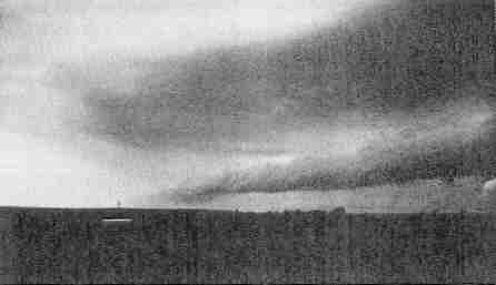 |
|
FIGURE 15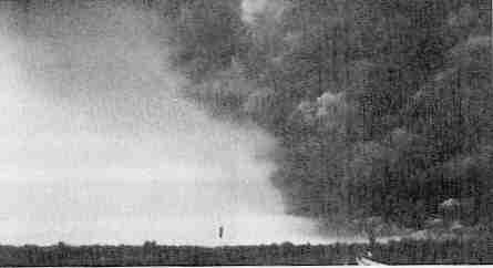 |
||
FIGURE 16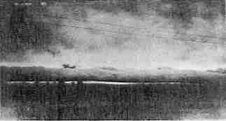 |